Last week, while enjoying a fanastic holiday in Sicily (Italy), I found out that there was just one item I couldn’t have missed: my GPS-enabled N82 mobile phone – working seamlessly together with Google Maps.
Even though we had enough maps and card-reading skills on board (I simply love maps and both my boyfriend and I are good at navigating), we have been thanking Saints Nokia and Google a few times for having helped us out.
Being used to Dutch traffic and roadsigns (all extremely well organized), Sicilian traffic and wayfinding takes some getting used to.
Apart from really needing all your sensors to stay concentrated on traffic alone [‘Keeping your lane” doesn’t really exist, there were easily 5 rows of traffic on a 2-lane + safety lane motorway], road exit signs are simply very hard to find. And usually placed after an exit, amongst all kinds of other highly distracting signs.
We therefor used Google Maps, together with regular maps and route descriptions from our picturesque yet sometimes quite remotely located Agriturismos and hotels.
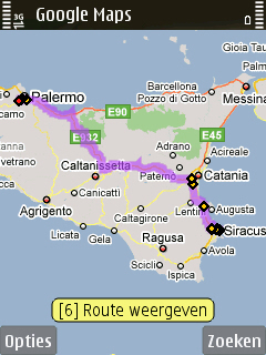
It works so easily. Just press “0” and the GPS tells you immediately where you are. Zooming in and out, scrolling – it is all so incredibly intuitive. The fact that you can choose any level of (non)-detail via Google Maps makes it very easy to get an overview of the entire journey and of the details.


Satellite mode
We also used the ‘Satellite’ mode (= Google Earth) multiple times, for example to find ourselves a nice beach on our way to the next destination or to locate the ‘teatro Romano’ (lower right on the picture) from our location near the ‘teatro Greco’ (upper left) in Sicacusa.
Again, the roadsigns at that point didn’t help us out, Google Earth did.
We didn’t even use the ‘search’ option for finding restaurants this time – this time we simply chose to follow our real life eyes, ears and nose to find lovely places to eat and drink…
So, where will this lead to?
Currently, there were no usable other mobile location services available for Sicily yet, apart from some very simple (but not so interesting) Lonely Planet content. But how would we have loved to get more information about the wonderful monuments ready at hand. However, this is just a matter of time- I’m sure that by next summer many of these services will be available. In the iPhone app store, you can already try out Wikime (link to article in Dutch).
My dream would be to point the camera of my phone at all of the archeological sites which make Sicily (and many other tourist destinations on this planet) so special – and see in the screen of my camera:
- how this site looked like in the old days
- how the people looked like, and what they were doing at that moment
This type of ‘Augmented Reality’ via your regular mobile phone is also only a few years away.
It could radically change the way we live our holidays… If we want to, of course. Luckily there’s always the possibility to switch off your mobile, simply get lost somewhere in the middle of nowhere and phantasize about how life and the historic sites could have looked like a long, long time ago.